
Introduction: The Growing Need for Air Quality Awareness
As wildfires rage in various parts of the world, the conversation surrounding air quality has intensified. With more frequent and severe fires, understanding the impact on air quality has become crucial for public health. Enter the smoke map—a visual representation of smoke particulate concentrations across regions, designed to inform communities about air quality levels. But how do these maps work, and why are they vital in today’s climate?
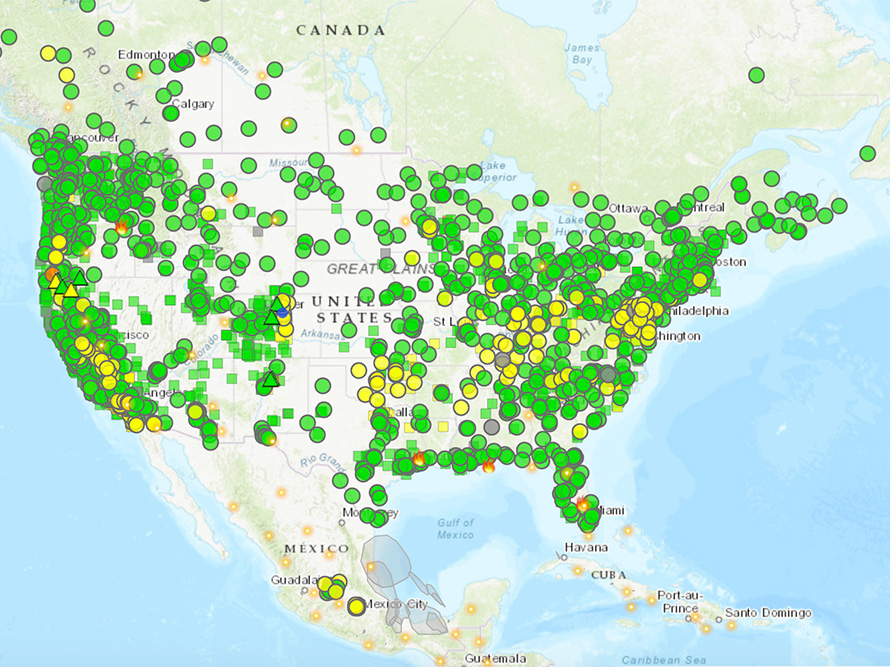
What is a Smoke Map?
A smoke map provides a visual depiction of areas affected by smoke from wildfires, industrial activities, or other sources. Utilizing satellite imagery, meteorological data, and air quality monitoring stations, these maps offer real-time insights into particulate matter levels, specifically PM2.5—fine particles that can deeply penetrate human respiratory systems.
The Technology Behind Smoke Maps
The technology used for creating smoke maps integrates sophisticated algorithms that analyze data collected from multiple sources. Researchers and environmental monitoring agencies leverage data from NASA satellites, ground sensors, and weather models to ensure accuracy. For instance, NASA’s MODIS (Moderate Resolution Imaging Spectroradiometer) actively tracks fires and smoke dispersion, feeding into comprehensive smoke maps.
Public Reaction and Usefulness
Public response to smoke maps has been overwhelmingly positive, particularly in areas prone to wildfires. Many people turn to these interactive tools for guidance on safe outdoor activities. “When our community was under heavy smoke advisories, the smoke map became a lifeline, letting us know when it was safe to step outside,” shared Sarah Thompson, a resident of British Columbia. Social media platforms are flooded with discussions about air quality, with users sharing screenshots of smoke maps as they assess the safety of their environment.
The Importance of Smoke Maps in Climate Change Context
As climate change continues to alter weather patterns, smoke maps are becoming increasingly relevant. Researchers have projected that wildfires will become more frequent and intense due to higher temperatures and prolonged droughts. This makes it vital for communities to stay informed about air quality.
Moreover, with smoky conditions affecting urban centers far from the fire, understanding how smoke travels is essential for public health. Smoke maps guide not only individual actions but also policy-making, influencing local regulations surrounding fire prevention and air quality improvements.
Looking Ahead: The Future of Smoke Maps
The next evolution in smoke mapping could incorporate machine learning algorithms, allowing for more precise predictions of air quality based on changing weather conditions and fire activity. Furthermore, increased public accessibility through apps and online tools could empower more individuals to monitor their health proactively.
Concluding Remarks
As we navigate a world increasingly marked by climate-induced challenges, smoke maps represent a vital asset in our collective toolkit for maintaining public health. By providing transparent, credible, and timely information, these maps empower individuals and communities to make informed decisions, fostering a climate of safety amid uncertainty.